City of SD awards Truax House bidder
Nakhshab Design & Development, the developer, submitted the highest bid for the property. The developer says the plan is to restore the house from its current disrepair; make part of the house available for public use; build new housing units on the site, including 10 percent to 15 percent affordable units; and work with nearby homeowners to provide an easement that would extend access to the Maple Canyon hiking trail.
The small parcel of land with two wooden houses, is located at the corner of Laurel and Union streets. The owner wanted to sell the homes, one (now vacant) was the first home for people living with AIDS (The A. Brad Truax House). Who owns them? The City of San Diego.
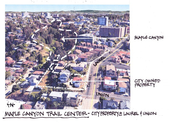
The neighborhood needs access to Maple Canyon. The image at the right (from Jim Frost) show how that could be possible.
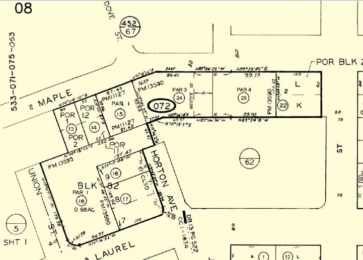
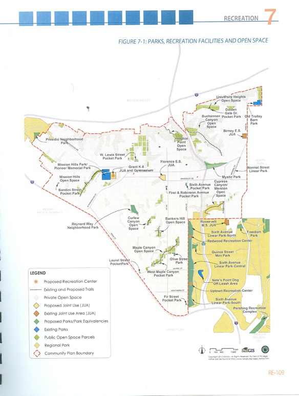
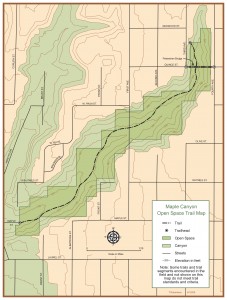
Shown here are several maps of the 2513 Union Street/540 West Laurel Street Property (“Truax House” site) and the Maple Canyon Open Space; including a parcel map, draft Uptown Community Plan Park/Open Space map from the draft Recreation Element, a aerial map, and a map of the Maple Canyon Open Space system.
From these documents it appears:
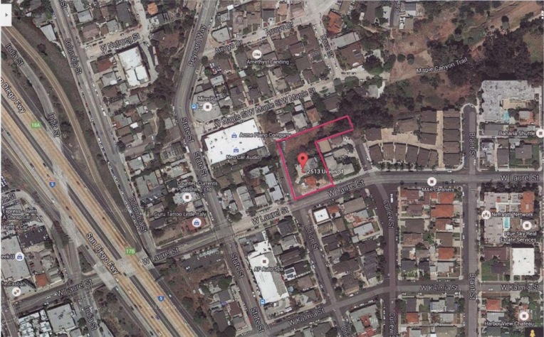
1.) The 2513 Union Street/540 West Laurel Street properties are listed in the draft Uptown Community Plan as “Public Open Space Parcels”; and are shown as part of the Maple Canyon Open Space system — which consists of public and private land designated as open space.
2.) The 2513 Union Street/540 West Laurel Street properties connect to Maple Canyon. There is something of a trail on the west side of the panhandle; the east side has no trail and is vegetated. The grade is relatively level; and suitable for a trail;
3.) East of Horton Avenue, the Union Street property has its eastern boundary. A vegetated area continues along the canyon side and becomes steeper. It is a relatively short distance downhill to the Maple Canyon trail head. An appropriate trail could be built along the hillside, taking into account the steepness of the terrain. It is a very attractive area with many large eucalyptus trees. It is behind the Cypress Hills Townhouses, which were built in 1998. At that time it was common for the city to require a developer to provide an open space easement for sensitive lands on a project site as a condition of approval. This may have happened in this case. One map indicates the land is privately-owned open space.
Many believe this is a good location for a western trail head into Maple Canyon. At places the land is steep, but there is still room for a trail; and there are nice views of not only the canyon, but also the San Diego Bay. The Truax House is impressive and would be an excellent interpretive center. Perhaps the time as come to honor Dr. Brad Truax for the role he played in the San Diego LGBT community and as an early AIDS treatment advocate.